Precise Positioning
Geophysical Exploration
Geophysical exploration is made up of predominantly seismic activity of both land and sea. It is used to map the subsurface structure of a region, to reveal the underlying structures, spatial distribution of rock units, and to detect structures such as faults, folds and intrusive rocks. Grid patterns are set up using GPS to locate the points on the grid. The grid is made up of a two-dimensional array of source points and receiver points. The method used to measure and graph what lies beneath the surface are seismic waves.
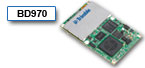
System integrators use Trimble’s latest centimeter-level positioning technology from Pacific Crest in products used for geophysical exploration. Trimble’s GPS/GNSS receiver modules form the backbone of equipment used to determine the precise location of the points on a geophysical exploration grid and are easily integrated into these systems.
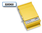
Trimble’s GPS/GNSS receiver modules from Pacific Crest ensure maximum interoperability with established GPS infrastructure that aids seismic geophysical exploration. Seismic exploration is the primary method of exploring for hydrocarbon deposits on land and under the sea by oil companies. Exact positioning accuracy is necessary to ensure time and money is not wasted in search for oil reserves as well as essential land resources such as geothermal areas and water resources.